Walks near Vernet-les-Bains and to Canigou
WALK DESCRIPTIONS (in English and French)
of the CONFLENT CANIGÓ TOURIST OFFICE*
(and other walks in Conflent)
The following documents are all in pdf format.
In each document, the translation in English is followed by the original "fiche rando" in French,
which contains a sketch map of the route.
* The original descriptions (in French) are also on the tourist office website here : www.tourisme-canigou.com
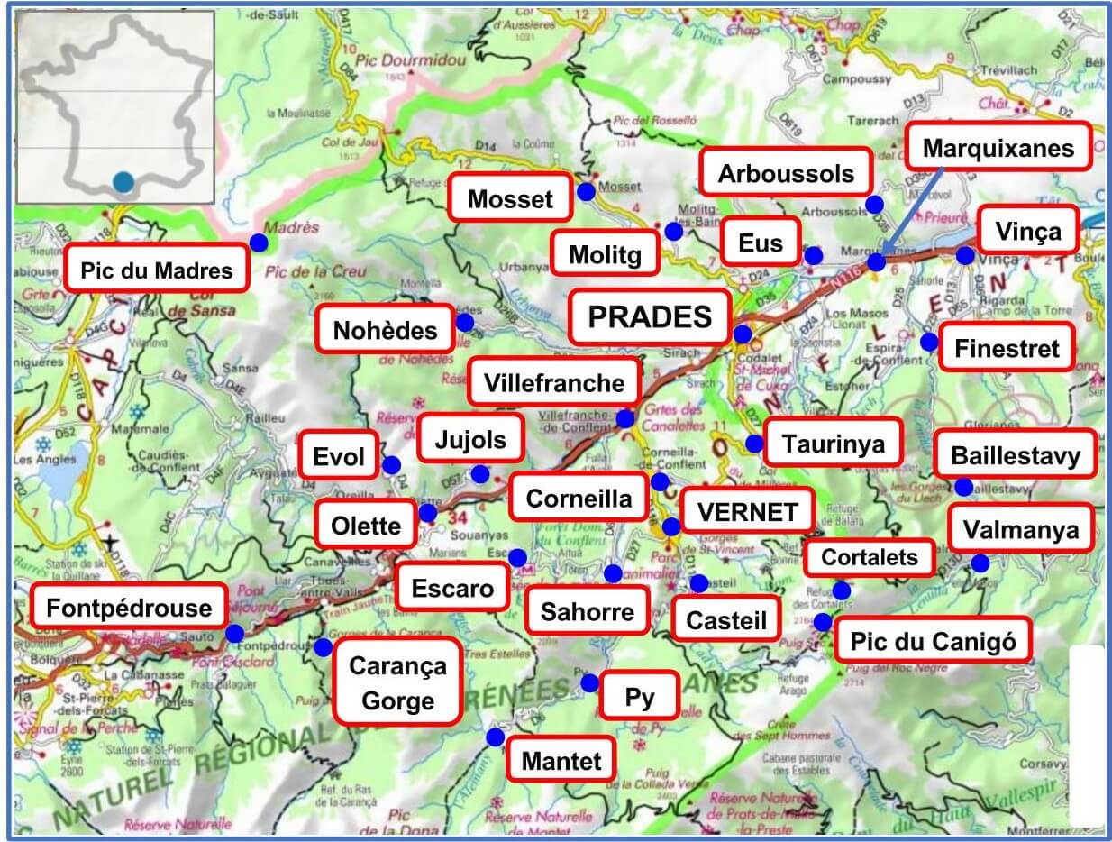
Vernet-les-Bains
Corneilla-de-Conflent
Casteil
Cortalets refuge and Pic du Canigó
Sahorre, Escaro and Fuilla
Py and Mantet
Villefranche, Ria and Prades
Taurinya, Codalet and Clara
Fontpédrouse, Thuès (Carança) and Nyer
Mosset and Nohèdes
Evol, Olette, Jujols, Joncet and Nyer
Prades/Molitg to Arboussols and Marquixanes
Eus
Vinça, Marquixanes, Finestret and Estoher
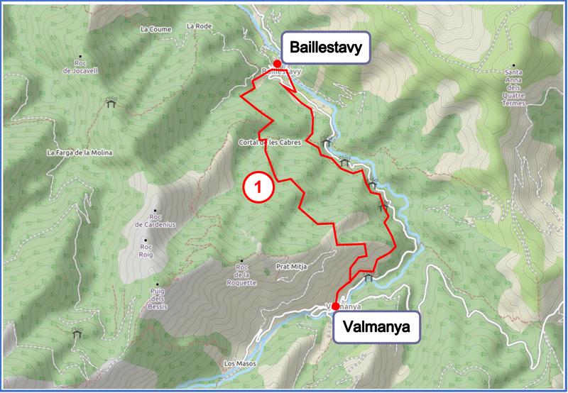
Baillestavy
Walks from Vernet-les-Bains
1 - A circuit in the Cady valley: pdf gpx
2 - The Pic de la Pena circuit: pdf gpx
3 - The Tour de Goa circuit: pdf gpx
4 - The Badabanys towers: pdf gpx
5 - High above the villages: pdf gpx
6 - The Cogolló circuit via the Resistance monument: pdf gpx
7 - The figure-of-eight walk: pdf gpx
8 - The Pic de l'Alzina via the Winter Garden: pdf gpx
9 - The “Belle Epoque” circuit: pdf gpx
And see elsewhere on this website:
10 - The waterfalls
11 - Vernet - Sahorre
12 - Vernet-Fuilla
Walks from Corneilla-de-Conflent
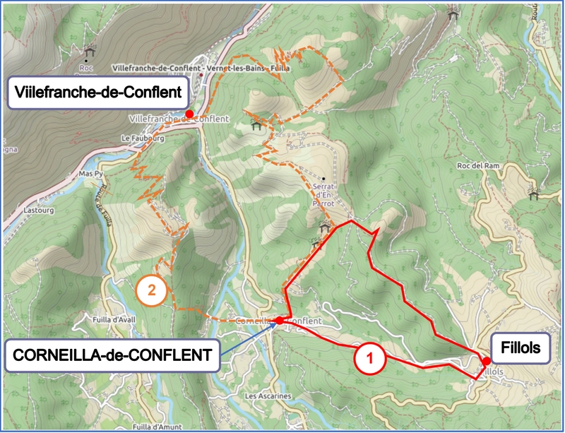
1 - The Corneilla-Fillols circuit (unavailable at present, but see: Corneilla - Fillols)
And see elsewhere on this website:
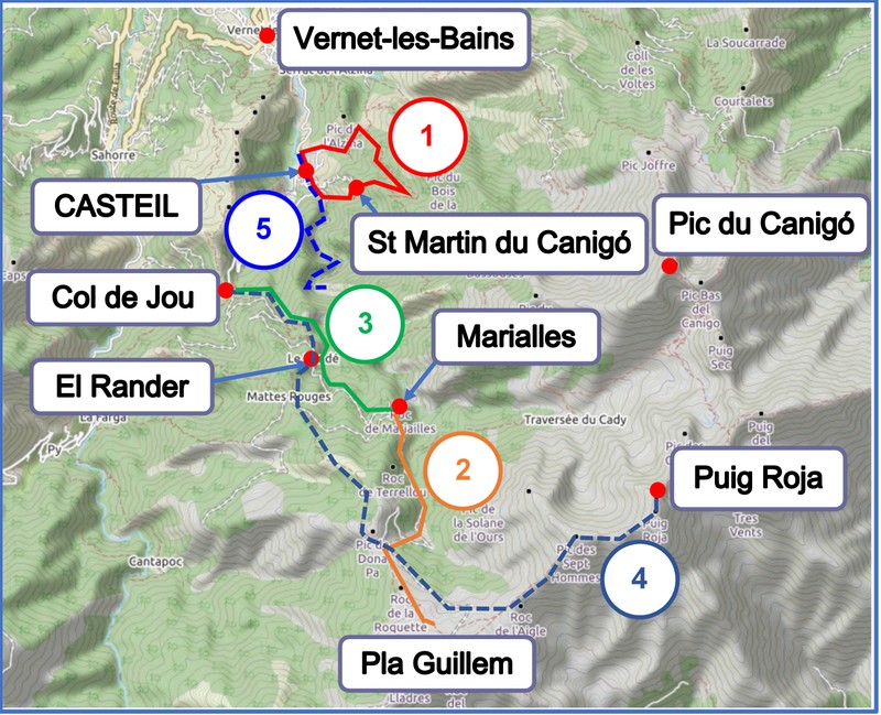
Walks from and near Casteil
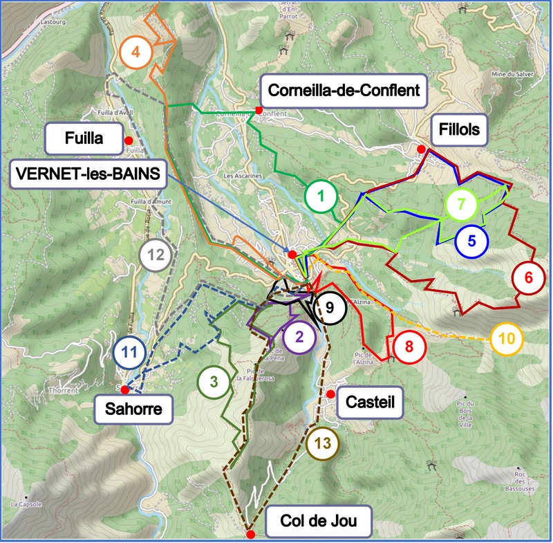
Walks to Cortalets Refuge and to the Pic du Canigó
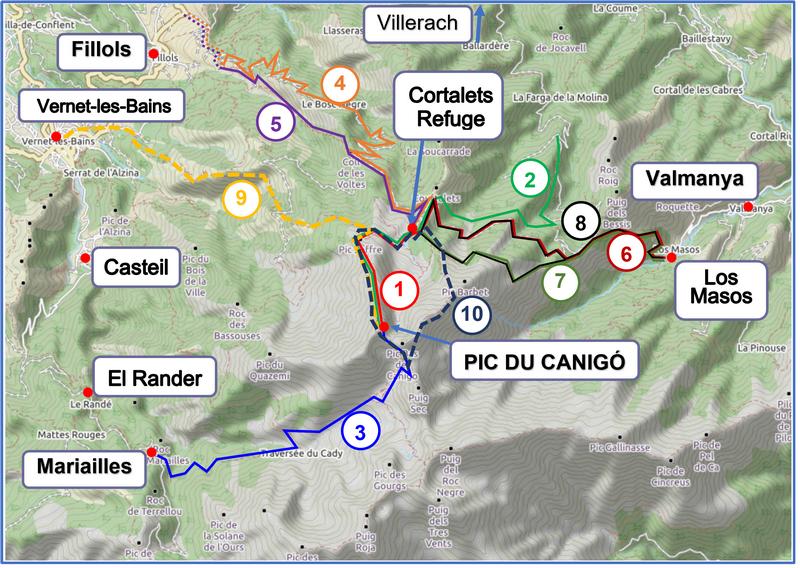
1 - Cortalets (refuge): Pic du Canigó: pdf gpx
2 - Villerach: parking de l'Esquena d'Ase - Cortalets - Pic du Canigó (unavailable at present)
3 - Casteil: Mariailles to the Pic du Canigó: pdf gpx
4 - Fillols (Coll de Milleres): to the Cortalets refuge, via the "Balaig" forest track: pdf gpx
5 - Fillols (Coll de Milleres): to the Cortalets refuge, via the Coll de les Voltes: pdf gpx
6 - Valmanya (Els Masos): to the Cortalets refuge, via the Bois de Patriques and the GR36: pdf gpx
7 - Valmanya (Els Masos): to the Cortalets refuge, via the Bois de Patriques and the GR10: pdf gpx
8 - Valmanya (Els Masos): the Cortalets circuit, via the GR36 and the GR10 long-distance paths: pdf gpx
And see elsewhere on this website:
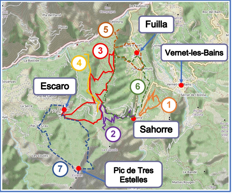
Walks from Sahorre, Escaro and Fuilla
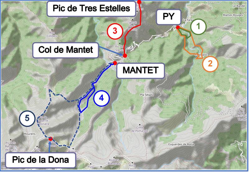
Walks from Py and Mantet
Walks from Villefranche, Ria and Prades
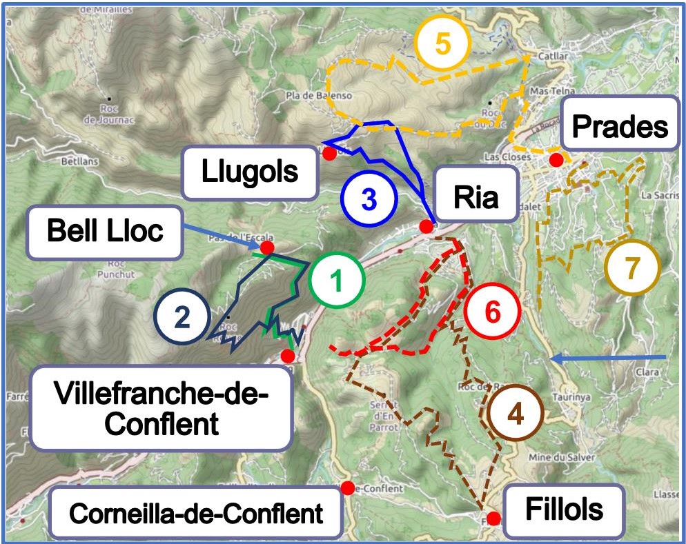
1 - Villefranche-de-Conflent: "Bell Lloc": pdf gpx
2 - Villefranche - St Esteve: pdf gpx
3 - Ria-Sirach: the circuit of the Majestic Pine Tree: pdf gpx
3 - Ria-Sirach: the circuit of the Majestic Pine Tree (version for smartphone): spdf
And see elsewhere on this website:
4 - Ria - Fillols
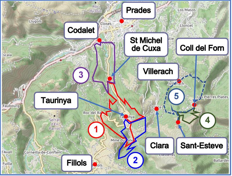
Walks from and near Taurinya, Codalet and Clara
Walks from and near Fontpédrouse, Thuès-entre-Valls (Carança) and Nyer
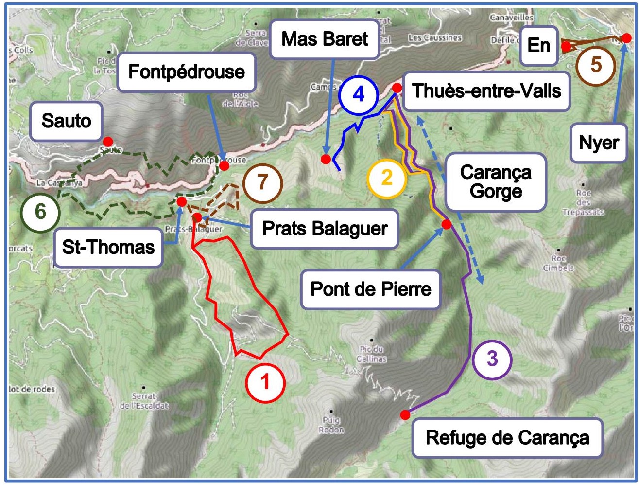
1 - Fontpédrouse (Prats Balaguer), the Cucurucull circuit: pdf gpx
2 - Thuès-entre-Valls, the Carança Gorge (as far as the stone bridge): pdf gpx
3 - Thuès-entre-Valls, the Carança Gorge (as far as the Carança refuge): pdf gpx
4 - Thuès-entre-Valls, the path to Mas Baret: pdf gpx
And see elsewhere on this website:
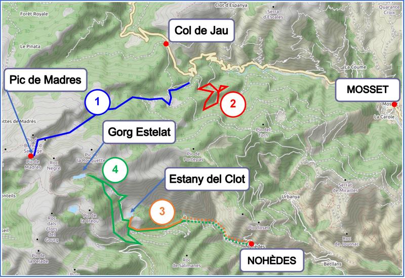
Walks near Mosset and near Nohèdes
Walks from Evol, Olette, Jujols, Joncet and Nyer
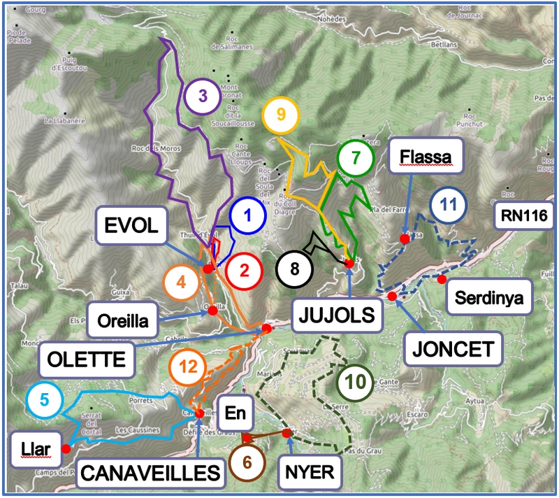
1 - Evol, the Castle Panorama circuit: pdf gpx
2 - Evol, above the village of Evol: pdf gpx
3 - Evol, the "Camí Ramader": pdf gpx
4 - Olette, the Evol-Oreilla circuit: pdf gpx
5 - Canaveilles, on the "road of the canons": pdf gpx
7 - Jujols, the heritage trail of the nature reserve: pdf gpx
8 - Jujols, the "Cami Menut" circuit: pdf gpx
9 - Jujols, the path of the mountain shepherds: pdf gpx
And see elsewhere on this website:
10 - Nyer - Marians - Souanyas
11 - Joncet - Serdinya - Flassa
12 - Olette - Canaveilles
Walks from Prades, Molitg-les-Bains, Catllar, Los Masos, Eus, Arboussols and Marquixanes
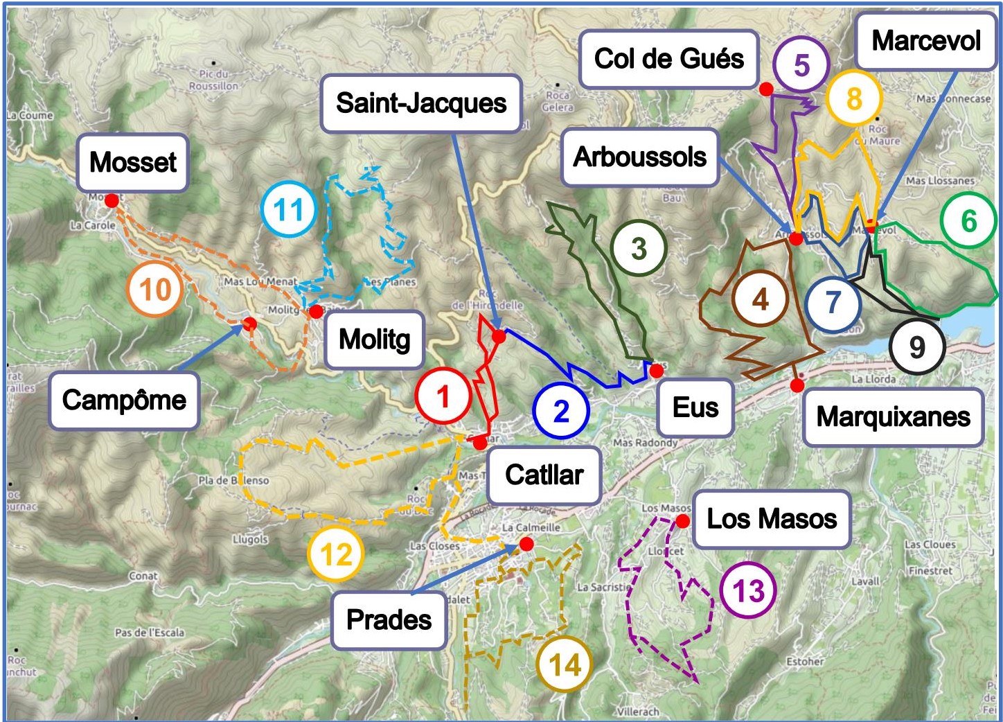
1 - Catllar, the path to the Saint-Jacques de Calahons chapel: pdf gpx
2 - Eus, the path to the Saint-Jacques de Calahons chapel: pdf gpx
4 - Marquixanes - Arboussols circuit: pdf gpx
5 - Arboussols: Col de Gués: pdf gpx
6 - Arboussols (Marcevol), the wayside shrines circuit: pdf gpx
7 - Arboussols: the village and priory circuit: pdf gpx
8 - Arboussols, the chapel and three churches circuit: pdf gpx
9 - The lower Marcevol priory circuit: pdf gpx
And see elsewhere on this website:
10 - Molitg-les-Bains - Campôme - Mosset
11 - Molitg-les-Bains - dolmen - les Planes
12 - Prades and the Vallensó plateau
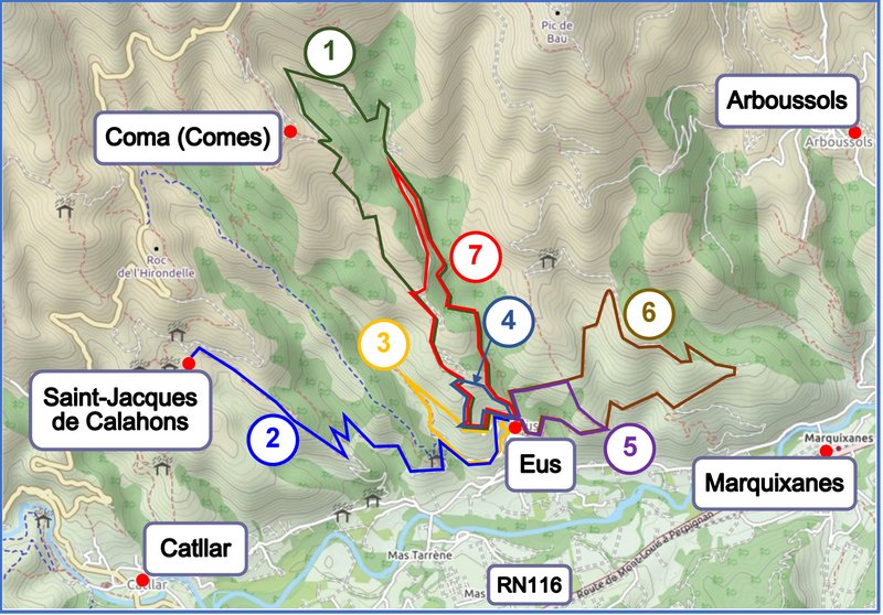
Walks from Eus
Walks from Vinça, Marquixanes, Finestret and Estoher
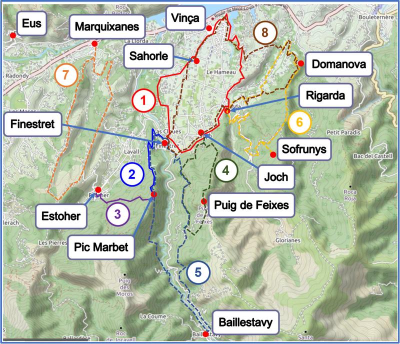
1 - Vinça, the "Baronnie" circuit: pdf gpx
2 - Finestret, Pic Marbet: pdf gpx
3 - Estoher, Pic Marbet: pdf gpx
And see elsewhere on this website:
6 - Rigarda - Domanova - Sofrunys
7 - Marquixanes
Walks from Baillestavy